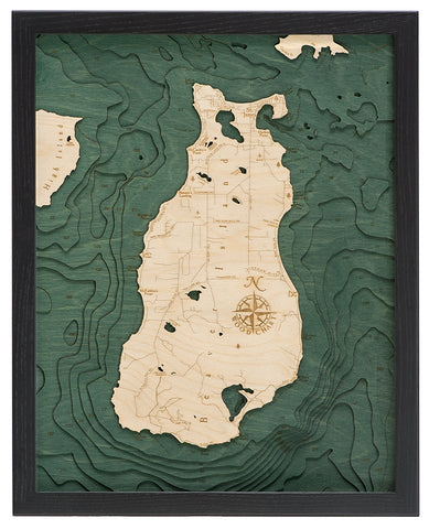
Mullet Lake and Burt Lake Wood Chart
$ 299.99
Both Burt and Mullet lakes are part of the Inland Waterway - a 38 mile stretch of lakes and rivers connecting Little Traverse Bay in Lake Michigan with Cheboygan on Lake Huron. The lakes were named after two federal surveyors - John Mullet and William A. Burt, who surveyed the area together from 1840 to 1843.
Points of Interest Include:
Cheboygan River, Chippewa Beach, Indian River, Kingsley Beach, and Royal Oak Beach
Measures 24.5" x 31". Wood charts are made from Baltic birch and have a solid wood frame. They come ready to hang.
Please note these ship directly from the manufacturer, located in Michigan and may contain "wood chart" on the outside shipping box.