Michigan Studio
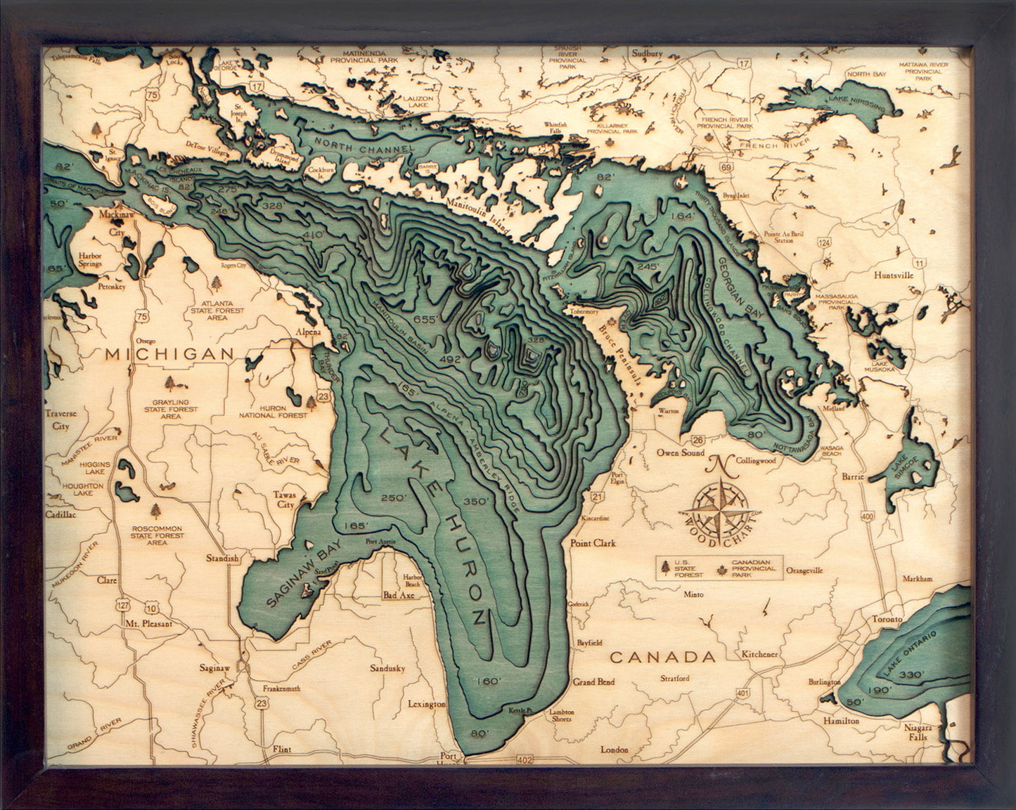
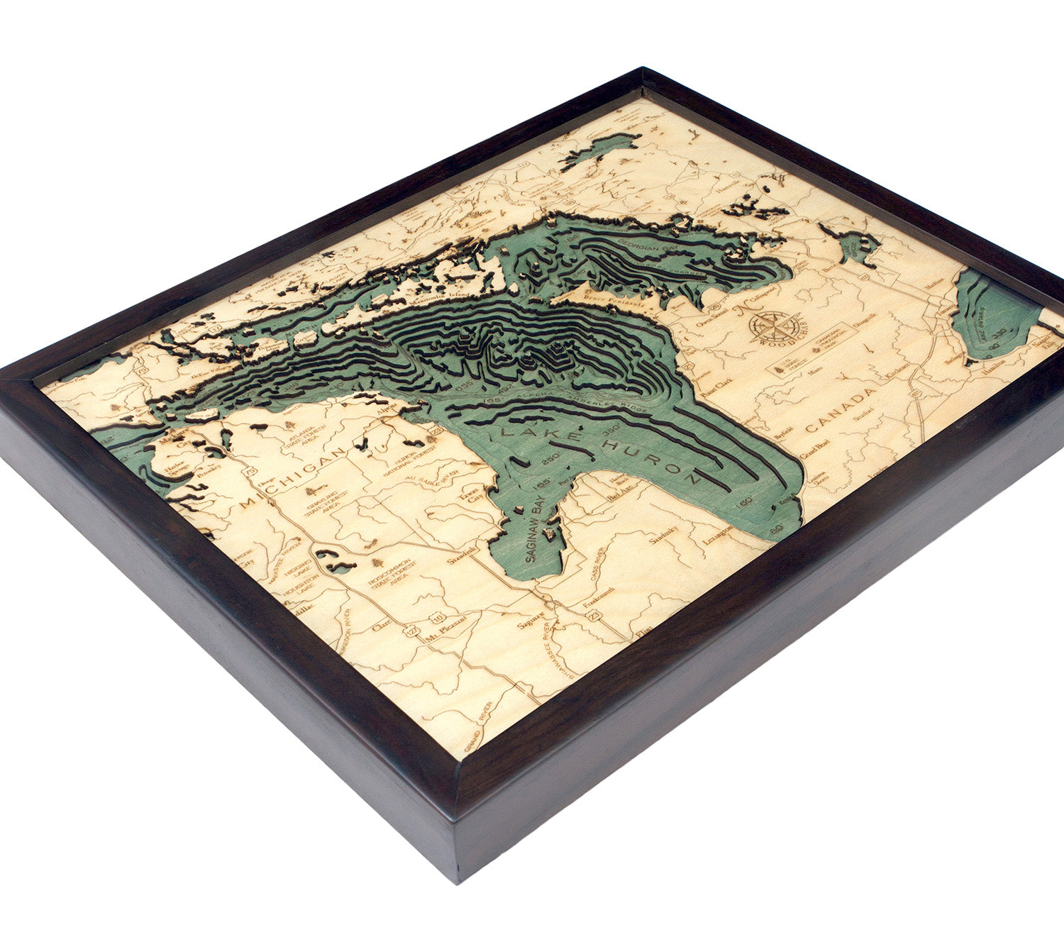
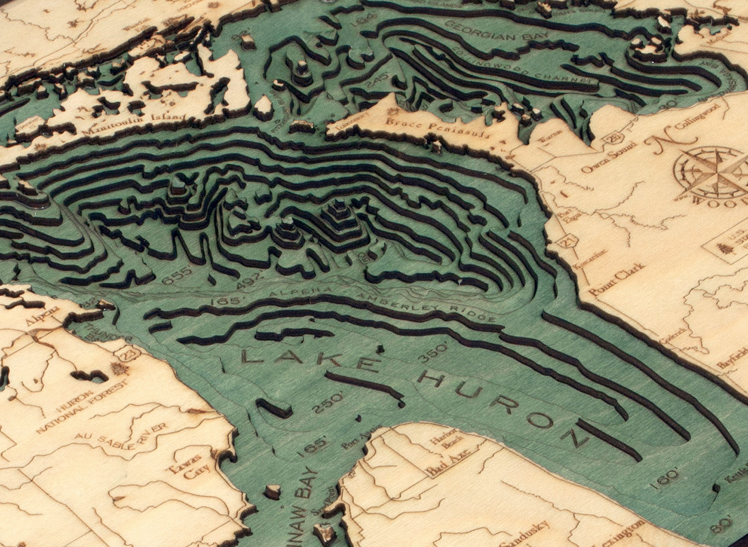
Lake Huron Water Depth Wood Chart
Lake Huron Water Depth Wood Chart
Couldn't load pickup availability
A 3-D nautical wood map featuring the second largest Great Lake. Lake Huron is home to the Georgian Bay, the largest bay in the Great Lakes, and also to Manitoulin Island, which is the largest freshwater island in the world. It's surrounded by the world's largest limestone quarries, and its beaches are sandy and shallow (excluding those along the coast of the Georgian Bay, which are rocky).
Points of Interest Include:
Saginaw Bay, Port Huron, Georgian Bay, Drummond Island, Mackinac Island, Mackinaw City, St. Joseph Island, and Sault Ste. Marie.
Wood charts are made from Baltic birch, have a solid dark wood frame and come ready to hang. Measures 16" x 20".
Please note these ship directly from the manufacturer, located in Michigan, and may contain "wood chart" on the outside shipping box.
Share